
The Spanish motorway network distinguishes two types of expressways: autovías, funded by the state and free of charge, and autopistas, historically granted to private operators and therefore toll roads. Since the expiration of several concessions, sections that were once toll roads have become free access, reshaping possible routes to cross the peninsula without fees.
Autovías and freed autopistas: how the free network is expanding in Spain
The distinction between autovía and autopista is not merely administrative. An autovía (prefix A-) has always been free. An autopista (prefix AP-) was under a private concession with toll barriers. When the concession expires and the state does not renew it, the autopista becomes free de facto.
Related reading : Practical tips for a smooth and stress-free move
The AP-7, along the Mediterranean coast, is the most visible case. Drivers crossing the border at La Jonquera can now drive toll-free well beyond Barcelona. This change has had a direct effect on summer traffic, with slowdowns becoming frequent on these heavily trafficked sections.
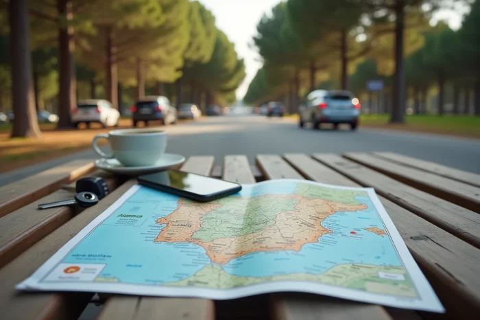
To plan a trip using a map of free Spanish motorways, it is necessary to check the current status of each AP section. The Ministerio de Transportes y Movilidad Sostenible publishes a schedule of expiring concessions. Several sections in Galicia and the Basque Country are expected to transition to free access by the end of the decade, with the political trend being not to renew concessions unless there is a major budget constraint.
You may also like : Discovering the luxury and adventure universe of Ponant

Spanish tolls: identifying still toll sections before departure
The autopistas still under concession are concentrated on a few routes. A simple marker to identify them: any section whose name starts with AP- and whose concession is still ongoing is a toll road. The prefix A- or E- (European routes) generally indicates a toll-free road.
The payment method at Spanish toll barriers accepts credit cards, cash, and toll tags. On this last point, services like Ulys or Fulli offer a single tag that works in both France and Spain. Fulli also covers some charging stations on the Spanish network, making it a dual-purpose tool for drivers of electric or plug-in hybrid vehicles.
Before departure, the most reliable method remains to plot your route on a GPS application by activating the “avoid tolls” option, then compare the travel time with and without this option. The difference rarely exceeds twenty minutes on major coastal routes but can increase significantly on inland crossings (Madrid-Bilbao, for example).
GPS applications to avoid tolls in Spain: Waze, Google Maps, and alternatives
Not all navigation applications handle Spanish tolls the same way. Two dominate the market, with distinct behaviors.
Waze and the “avoid tolls” setting
Waze allows you to permanently configure a toll-free route in the navigation settings. The app recalculates in real-time based on traffic, making it particularly useful on the AP-7 in summer when slowdowns on free sections lead some GPS devices to suggest a paid detour.
Waze also reports mobile speed cameras and controls, a concrete advantage on Spanish autovías where the Guardia Civil regularly deploys speed control devices.
Google Maps: reliable but less responsive
Google Maps also offers the option to avoid tolls. Its mapping is accurate and regularly updated to incorporate changes in the status of autopistas. However, community reports (speed cameras, incidents) are less responsive than on Waze.
For a road trip in Spain, combining both applications yields the best results: Google Maps for pre-trip planning (route comparison, time estimation), Waze for real-time navigation.
Offline applications and complementary tools
In areas with low network coverage (some sections in Aragon, Extremadura, or the sierras), an application that works offline becomes necessary. Several criteria can guide the choice:
- The ability to download regional maps before departure, with recent updates on toll statuses
- Management of height restrictions for motorhomes, which cannot use certain sections or tunnels
- Display of gas stations and rest areas, whose density varies greatly between main autovías and secondary roads
Applications like Maps.me or OsmAnd utilize OpenStreetMap data, often more detailed than commercial maps on Spanish secondary roads.
Multi-country toll tags and electric charging: tools that change the journey
Guides focused on the free Spanish motorways often overlook a practical use: toll services now also cover electric charging. For example, Ulys indicates that its charging card works in France and Spain, allowing for the management of residual tolls and charges with a single account.
For drivers of combustion vehicles, the toll tag remains useful on the few autopistas still charging, especially in the Basque Country and Galicia, where traditional barriers can create queues during peak season.
The question of the free Spanish network evolves each year. Before each trip, checking the concession schedule from the Ministerio de Transportes remains the safest reflex. Sections that transition to free access do not revert, and the map of the toll-free network continues to expand.